Holland history: Getting around town
Among other things, Dale Wyngarden is an amateur historian. He has graciously shared a series of histories he created for the Tulip Time trolley tours that have since changed format. In this installment: From roads laid out in grids to the Interurban railway, Holland's history is tied to transportation.
Editor’s note: This is the first in a 10-part series weekly on the history of the Holland area.

Holland has a rich history, and much of it has been driven (pun intended) by how we get around.
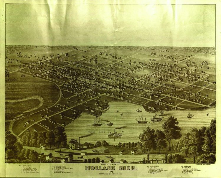
Unlike the layout of communities in the Netherlands, which tend to be guided by natural features — predominantly water — the plan for Holland followed a typical grid pattern seen throughout many Midwestern cities. Before statehood, the Northwest Territories, consisting primarily of today’s upper Midwest states, including Michigan, was surveyed and platted into square “townships,” consisting of 36 square miles. Six miles by 6 miles, each township was further subdivided into thirty six “sections,” 1-mile-square, each containing 640 acres. A quarter section, or a fourth of a square mile, was 160 acres. A quarter of a quarter was 40 acres. This was the framework of the Midwest that guided land sales and division when van Raalte and early settlers purchased lands for their villages or surrounding farmlands.
Grids
The grid street system guiding our development for a century or more consists of rectangular blocks that vary in length, generally within the range of 500 to 1000 feet. The width of blocks was uniform, however. Distance from centerline to centerline of numbered streets is exactly 330 feet. Sixteen times 330 feet is 5,280 feet. So sixteen numbered streets fit precisely into a mile. Eighth to 16th equals a half mile. Sixteenth to 32nd equals a full mile. This grid system made laying out blocks and lots relatively easy and prevailed until curving residential streets and irregular lot sizes became trendy in the latter half of the 1900s.
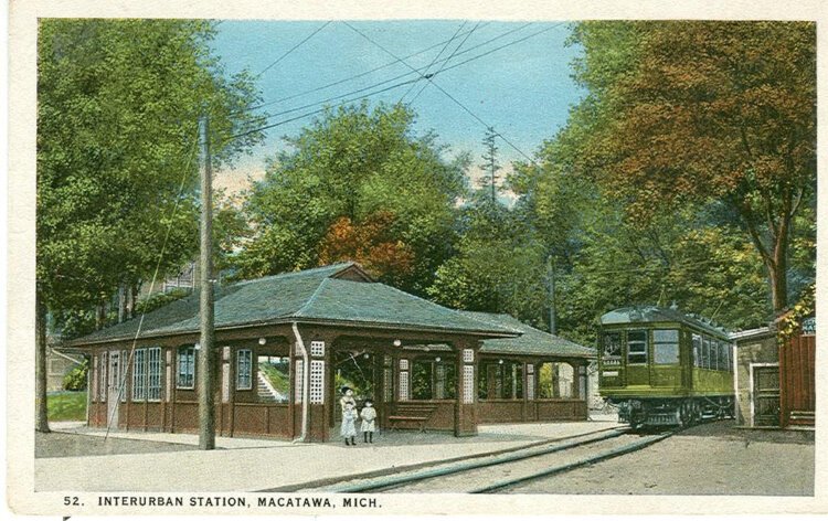
The Interurban
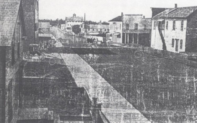
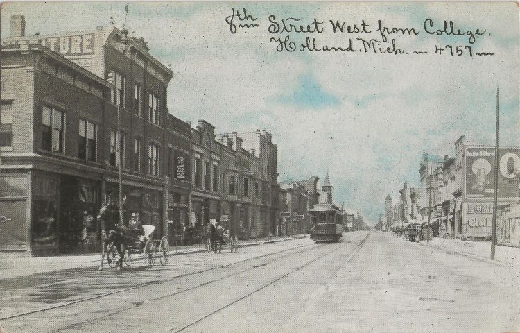
Eighth Street emerged as Holland’s typical small town “main street.” It was a destination reached by foot or by horse for at least its first six decades. With no need for parking lots, buildings hugged each other to make shopping convenient. For roughly two decades — 1901 to 1926 — an electric interurban railroad connected Holland’s beaches and resorts to Grand Rapids, running down the center of Eighth Street. Henry Ford and affordable cars brought a quick end to the interurban era, and by the mid 1920s, interurban systems were abandoned and tracks were being torn up for salvage.
Meanwhile, a Federal Highway Administration had been established to connect the country with a national highway network. U.S. 31 linked Chicago to Holland and northern Michigan. Since downtown streets were often the first to be paved, highways typically ran through the hearts of downtown. In Holland, River Avenue and Eighth Street became part of a designated federal highway that continued on to Chicago on the old Blue Star Highway. But by the 1960s, highway traffic was making downtowns inhospitable places, and downtowns had become congested bottlenecks for highways. The age of “bypasses” had arrived, and Holland’s U.S. 31 bypass was built a half mile east of downtown through what was mostly a rural fringe in 1960.
Bypassing downtown
Most bypasses ran through such rural fringes, and it wasn’t long before motels both replaced tourist cabins of the 1930s and cut into the viability of old downtown hotels. By the 1960s, downtown’s Warm Friend Hotel was shuttered. Along with motels, franchise restaurants soon sprang up along the bypass, further taking a toll on the historic downtown family restaurants. The biggest threat to downtown came with the advent of malls, however. In 1983, both Westshore Mall and Holland Outlet Mall opened. Westshore had four anchor stores. Three of them — Sears, JCPenney and Steketees, a major regional department store — were relocated from downtown.
Eighth Street faced an uncertain future.
Dale Wyngarden worked for the city of Holland for three decades, much of that time overseeing the Planning and Development Department during the revitalization of the downtown. Now happily retired, he spends his time writing and gardening.
Author

Related Articles
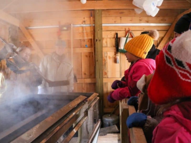
March things to do: St. Patrick’s Day events, youth concerts and art, and tapping sugar maple trees
In addition to usual suspects — music, movies, art, history, and crafts — don’t miss the business expo, home show, garden classes, blood drive, StoryWalk, egg hunts, and more in this month’s calendar.
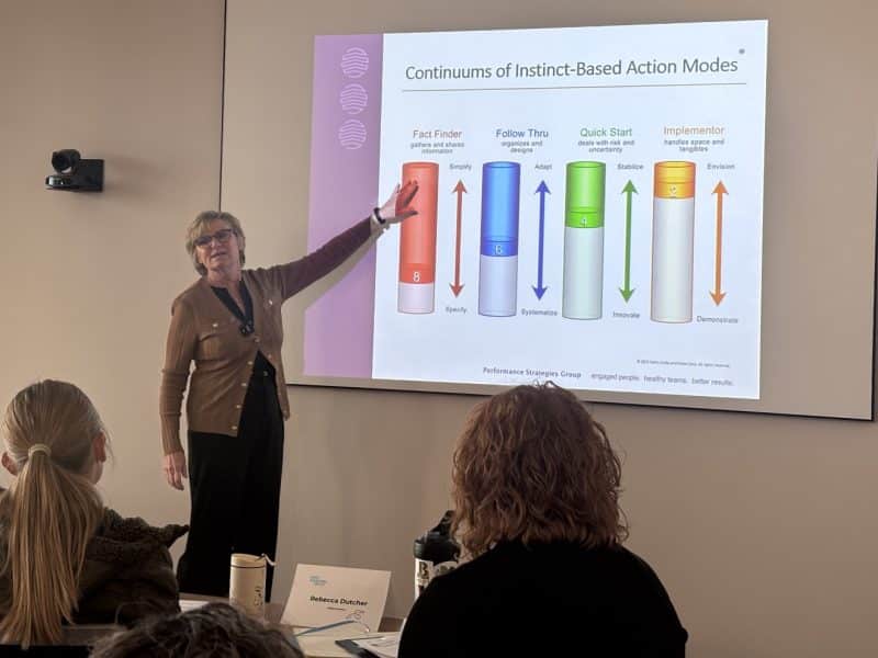
Leadership tool helps nonprofit, church leaders strengthen teams and collaboration
New Lakeshore Nonprofit Alliance director Kory Plockmeyer shares how a leadership tool, guided by consultant Mari Martin, helps nonprofit and church leaders understand teams, reduce friction, and lead more effectively.

New campaign seeks to reduce Michigan businesses’ food waste by doubling food donations
Community Action House in Holland is among the partners participating in a new initiative led by the nonprofit Michigan Sustainable Business Forum that aims to double the amount of food Michigan businesses donate to food banks and food rescue organizations.